Not just a legend: Discovery of ancient industrial remains at Oak Island has left experts stunned!

A major excavation in the western region of the island’s mysterious swamp has uncovered a sophisticated, sand-covered cobblestone road that researchers believe could pre-date the earliest known surveys of the area. The discovery has ignited a new theory among the Fellowship of the Dig: that the island’s modern thoroughfare, Center Road, was built directly atop an ancient transit system used to move massive amounts of cargo toward the Money Pit.
The excavation, led by Peter Fornetti, Gary Drayton, and heavy equipment operator Billy Gerhardt, has exposed a unique “sand and cobblestone” feature. Curiously, the road is lined with eight-sided wooden survey stakes—the same type of artifacts recently analyzed by archeoastronomy expert Professor Adriano Gaspani.
The 13th-Century Connection
Professor Gaspani’s recent findings have cast a long shadow over the current dig. His analysis of similar eight-sided stakes found in the northern swamp suggested they were positioned in the early 13th century to align with specific celestial bodies. If the stakes lining the new sand road match this timeline, it would place the road’s construction nearly 500 years before the discovery of the Money Pit in 1795.
“This isn’t some random stakes plonked in the swamp,” metal detection expert Gary Drayton observed. “There’s a pattern going on here. It’s an involved, purposeful effort.”
The Ox Shoe Evidence
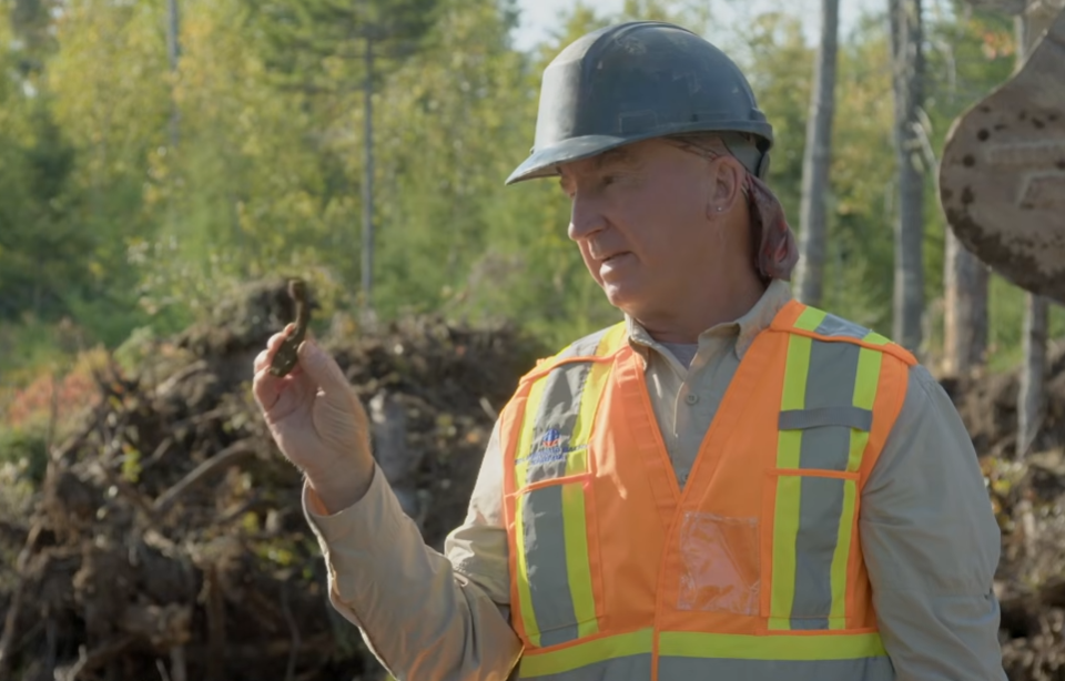
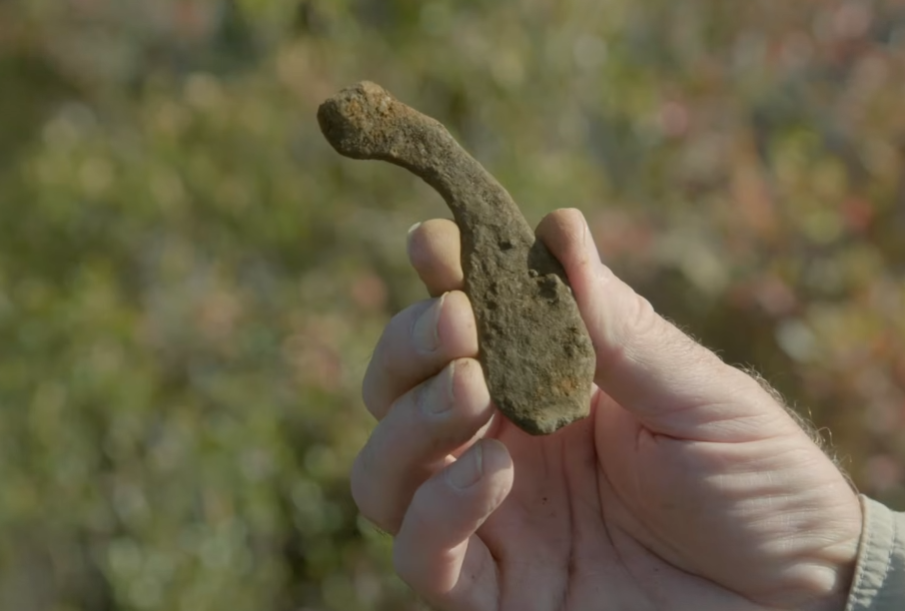
Deep within the sand layer of the road—approximately one foot below the surface—the team recovered a heavily encrusted iron ox shoe. The artifact is seen by the team as “smoking gun” evidence of heavy industrial hauling.
“Ox shoes mean signs of activity—people traveling over this area,” Drayton explained. “They were taking oxen to the Money Pit, and this is where a shoe was shed. It’s signs of hauling, maybe treasure.”
The trajectory of the road is equally compelling. It appears to be heading directly toward a “Portuguese-style” stone road in the southeast corner of the swamp. This suggests a unified, island-wide infrastructure designed for the transport of heavy materials between the shore and the uplands.
Did the Survey Follow the Road?
One of the most radical theories to emerge from the week’s work concerns the 1762 survey conducted by Surveyor General Charles Morris, a prominent Freemason. While history suggests Center Road was created by treasure hunters in the 1800s following Morris’s lot divisions, the team now suspects the opposite might be true.
“Was this road here first, and they came in to survey the island and said, ‘Let’s use this line’?” Craig Tester posited. “Maybe the survey was based on the road as opposed to the other way around. It’s mind-boggling.”
The Lot 5 “Base Camp” Link
The team believes this road provides the “missing link” between Lot 5 and the Money Pit. Excavations on Lot 5 since 2022 have revealed 14th-century valuables and a rounded stone foundation with mortar that matches material found deep within the Money Pit shaft.
If the sand road runs beneath Center Road all the way to Lot 5, it would confirm that the lot served as a primary base camp for a massive, pre-colonial engineering project.
“The work to get that treasure up there involved this road,” Rick Lagina concluded. The team has now moved to begin a cross-section excavation of Center Road to see if the “ancient path” continues beneath the modern surface.