MAPS, MONUMENTS, AND THE “HATCH”: Convergence of Data on Oak Island
History’s most expensive game of “connect-the-dots” has taken a dramatic turn. For the Lagina brothers and their team, the hunt for the Oak Island treasure is no longer just about digging blindly into the mud; it has evolved into a sophisticated forensic analysis of ancient cartography.
This week, the team successfully bridged the gap between 14th-century theory and 21st-century physical evidence, locating key landmarks that suggest the Knights Templar may have left a literal “X marks the spot” in the form of massive boulders and hidden structures.
The Second Anchor: 14th-Century Geometry in the Field
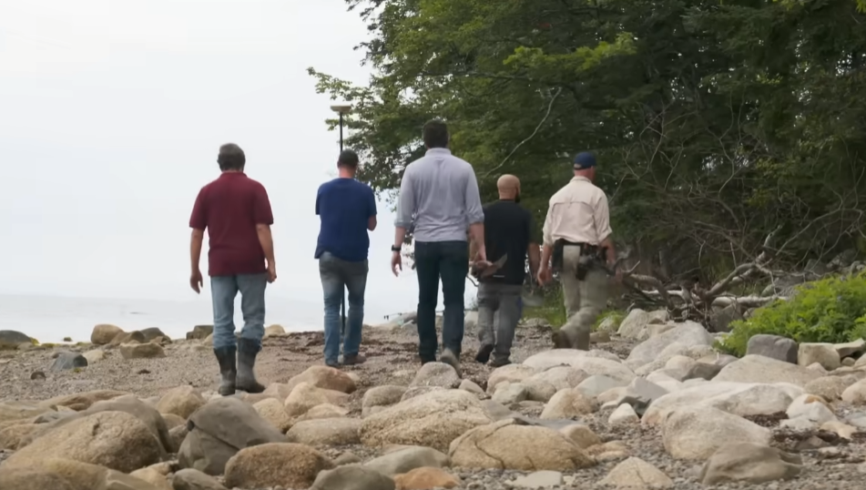
The search intensified on the island’s northern shore, specifically at the “Boulderless Beach.” Guided by the research of theorist Erin Helton and Lidar data, surveyor Steve Guptill led the team to a massive boulder believed to be the “North Anchor” of a 14th-century Templar map.
The discovery was striking. The stone isn’t just a random rock; it mirrors the “South Anchor” in size, shape, and geological composition. Perhaps most tantalizingly, Alex Lagina noted a possible carving on the stone—a “T” or cross shape reminiscent of the Westford Boat Stone in Massachusetts.
“It’s two for two,” Steve Guptill noted. “She [Erin Helton] sees both of them in the Lidar data, and here they are.”
According to theorists, these anchor stones were not just for mooring ships but served as terrestrial survey markers. If Helton’s triangulation is correct, these stones point directly to a specific point in the Money Pit area—an alignment that falls within three feet of the team’s current primary target.
The Zena Halpern Map: A French Connection
While the field team was busy on the beach, the “War Room” was abuzz with a different set of documents. The late researcher Zena Halpern provided a hand-drawn French map, which some believe dates back as far as 1347.
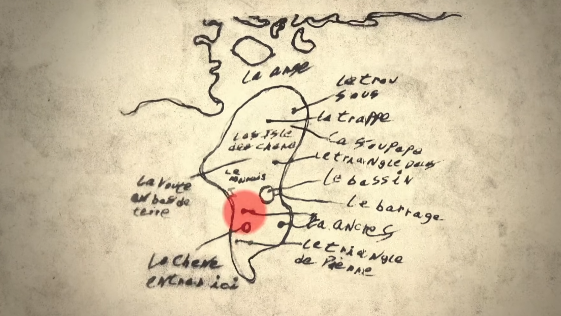
The map uses a nomenclature that aligns eerily well with the island’s geography:
-
The Basin: Correlates to the swamp on the Nolan side of the island.
-
The Dam: Points to a log wall structure articulated by the late Fred Nolan.
-
The Oak: A directive to “enter here” at the Money Pit.
-
The Valve and The Hatch: Mysterious features that have never been verified—until now.
Finding “The Hatch”
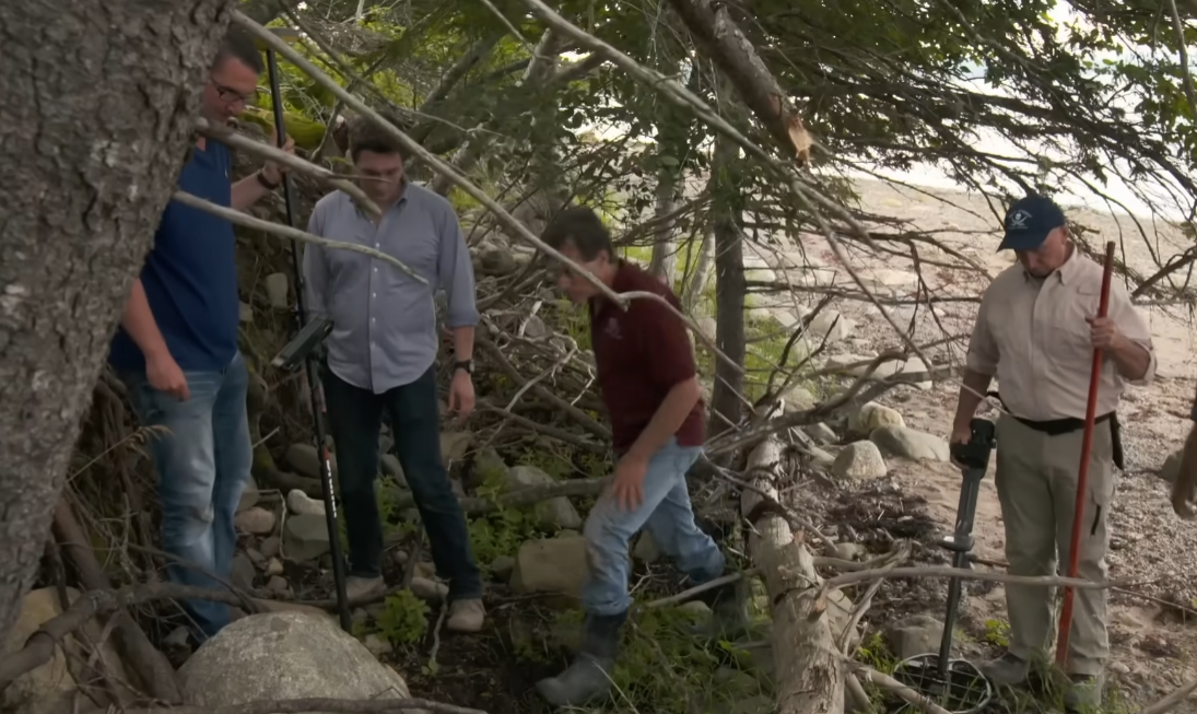
The most gripping development occurred on the western side of the island. Area historian Doug Crowell and Jack Begley used satellite imagery to overlay Halpern’s ancient map onto modern Oak Island. The projection placed the mysterious “Hatch” in the vicinity of Dave Blankenship’s property.
Dave Blankenship, a man who knows the island’s terrain better than perhaps anyone alive, led the team to a strange depression in the ground he had discovered while hunting. Upon inspection with archaeologist Laird Niven, the anomaly appeared to be anything but natural.
“That’s not natural,” Niven confirmed, observing the loose filling and the way rocks seemed to have been purposefully removed to create a square-shaped entrance. “It keeps going for a bit… it goes off to the side.”
The team’s immediate hope? That this “hatch” is a back door or ventilation shaft into the Money Pit tunnel system.
Science Over Speed
Despite the excitement of finding a potential entrance to the vault, the Laginas have opted for a “responsible and scientific approach.” Rather than tearing into the earth with a backhoe, the team is pursuing official archaeological permits from the Canadian government to investigate the site properly.
As Marty Lagina put it, the island is built on “rumor, conjecture, and hope,” but for the first time in 200 years, the documentation is finally starting to match the dirt.